Rewind: Return to Galloway — The Dungeon Hills
Posted on Saturday, 17th March 2012
I keep saying it, but I’ve been terrible over the last year or so at keeping up to date with processing and posting my photos, and writing about them.
Finally, I’ve finished sorting out the photos from my August 2011 return trip to Galloway Forest Park — prompted by planning a trip to the Isle of Arran this Easter. We’d actually originally intended to go to the Isle of Arran for the August Bank Holiday. However, due to a lack of planning, we decided at the last minute to return to Galloway, with the challenge of walking the Dungeon Hills range — from near Loch Doon, to Loch Dee — in a day. We’d planned to do this on our previous trip to Galloway Forest Park, but due to weather and tardiness, had abandoned the idea. I took my Canon EOS 450D with EF-S 17-55 f/2.8 IS lens and my Manfrotto tripod (which didn’t get used!).
Day One — Castle Doon & Fore Starr
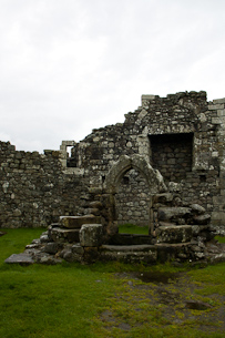
For the first day, we planned to arrive at Loch Doon, park the car near Castle Doon, and explore for while before heading to the evening’s campsite. Unfortunately, we were stuck in traffic for several hours on the way and arrived later than planned. We still had time to have a look around Castle Doon, however, before beginning the short 5km walk into the glen south of Doon. Sadly, the weather had turned overcast.
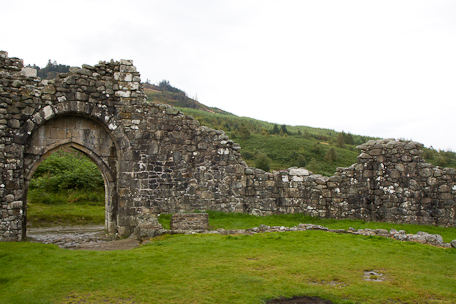
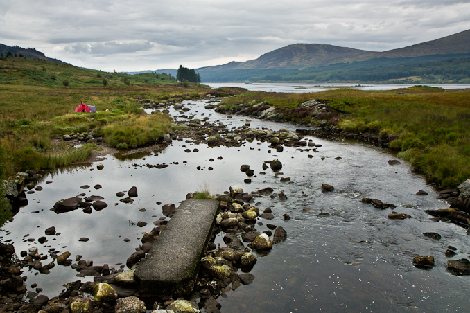
The walk to our campsite took us along the shores of Loch Doon, where we crossed the Carrick Lane which flows into the Loch. There is a nice little waterfall there where we saw a couple camped out and indulging in a spot of fishing. Beyond the Carrick Lane, the track turns into the forest, as it continues south and diverges from the Loch’s coast a little. Then, toward the sourthern tip of Loch Doon we crossed the waterfall where the Gala Lane approaches the loch. While the weather wasn’t up to scratch, the scenery certainly was.
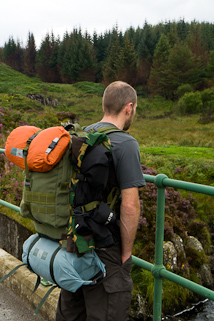
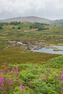
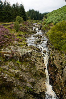
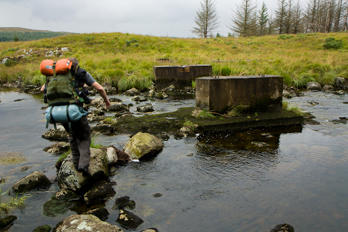
After ignoring not seeing some warning signs that prohibited walkers from the forest path towards where logging was taking place, it was only a short walk to the footbridge that would take us across the Gala Lane and into the rough, tussocky, trail-less terrain between us and our destination. We followed a short track down from the main forest trail to the river, where we were disappointed to find that the footbridge was gone! Fortunately, the river is not wide or deep, and there were suitable stepping stones across anyway. I snapped a quick shot of the crossing before packing the camera away as thunder rumbled overhead and the heavens opened.
Once on the other side of the river, the distance to the campsite was not that far. However, over that terrain, we were slowed down significantly, and the rain did not help. When we emerged from the treeline and saw the site, we were relieved. Happy to get to a place that had served as a perfect campsite on our last trip, and that we planned to use as a kind of basecamp for the main part of the trip (we planned to stay there on the first and third nights of the trip).
The problem was one we had read of. One we weren’t really expecting to be as bad as it was. The infamous Scottish midge. They were unstoppable!
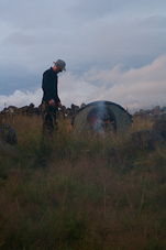
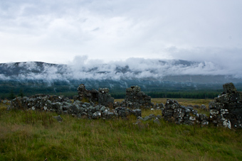
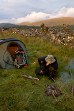
We started a small fire — on a mound of collected dirt, to prevent damage to the grass — to try and create some smoke to scare them away. It was pretty much ineffective. We got to having a brew and cooking the evening’s meal, and while the midges were trying their best to spoil things, we were treated to some amazing views of water vapour raising from the forest, the Dungeon Hills in the mist, and a beautiful sunset.
Day Two — The Dungeon Hills
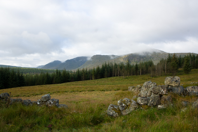
On the first morning (the second day), we arose early, bearing in mind the fact that tardiness and spending a long time boiling water over a fire had cost us our attempt at the hills on our last trip. We got up and packed up immediately so that we could set off and make progress before breakfast.
We aimed to cross over the northern foot of the Dungeon Hills range into the glen adjacent to the one we were currently in, so that we could meet up with the Eglin Lane for breakfast and a water refill. The terrain was every bit as difficult as we had remembered. However, the weather was good, the sun was shining and it was nice and warm.
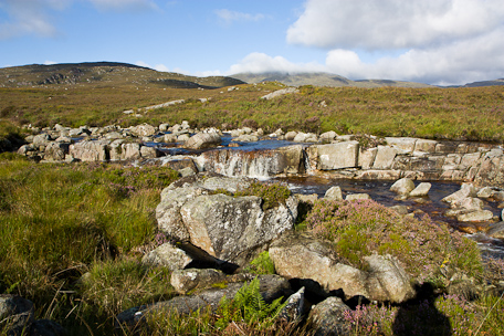
Getting to the Eglin Lane was a welcome relief. There was a lovely little waterfall a few hundred metres south of the sheepfold that marks the confluence of the Eglin Lane and Black Garpel, which flows from Loch Macaterick. It was a really pleasant place to stop and fuel up for the exhausting day ahead.
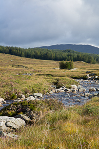
Once we had a brew and a hearty rehydrated hot breakfast inside us, along with some chlorine-treated water in our packs (our haste leaving us exposed to risk of Giarda – not recommended!), we headed off for the first of the four hills of the Dungeon Hills range we would walk over: Hooden’s Hill.
Thanks to the early start, by 10am we’d made good progress into the long (2km) ascent of Hooden’s Hill, reaching the Wolf’s Slock. Here, with the weather still playing ball, we were able to drink in the views of the glens they opened up below us.
It’s at those moments that I realise that I have a love/hate relationship with Galloway Forest Park because of its two very different characters. In the depths of the glens, and especially within the forest, the terrain is very wet and difficult to cover — it has you cursing the place and resolving to never return.
From the hills, however, the beauty of this vast landscape can’t fail to impress. Sometimes you think you are in Canada when looking at the large sections of forest, broken only by firebreaks.
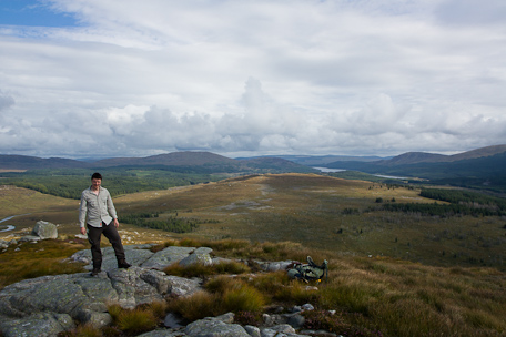
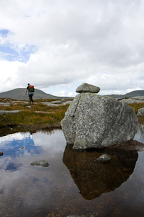
Once we’d dispatched Hooden’s Hill, it was time to descend a short way and then begin our climb of the tallest hill on our schedule: Mulwachar, which stands at 692m. It’s by no means a mountain, and not the tallest hill in the area — that credit goes to Merrick, at 843m, which we’d visited on our last trip.
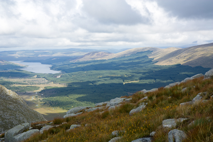
Shortly after 12, we’d reached the cairn at the peak of the hill and had time to take some pictures and sit down for a brew on a conveniently bench-shaped rock before the weather turned on us. Here, I took the opportunity to take a 360° panorama from the cairn, showing the surrounding area. The cairn in the picture obscures the Dungeon Hills from which we’d come, but on the left of the image is the Merrick and the Range of the Awful Hand. On the right, the Rhinns of Kell which lead north, above the glen containing the Silver Flowe and Gala Lane, towards Loch Doon, where our adventure started less than twenty-four hours ago.
We didn’t have enough water left (we were usually only carrying a litre or so each at a time, to keep weight down) for lunch, so we’d planned on having that after descending and refilling in a stream below Dungeon Hill. On the descent we spotted three or four wild goats and wondered if they were part of the same group we’d seen in the distance on a ridge whilst we walked over Hooden’s Hill. I turned away to take a photograph of the ameoba-like Loch Enoch, and when I turned back there must have been twenty or so goats, looking at us with some suspicion. As we reached the stream, we saw a group of four walkers pass us in the opposite direction, they’d just come down Dungeon Hill and were about to ascend Mulwachar. After a short stop, and a lovely rehydrated soup, it was on to hill number four, and the range’s title act: Dungeon Hill. Fortunately, the variable weather had turned again and it was bright and sunny.
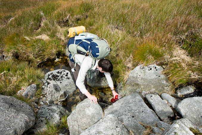
To be honest, Dungeon Hill was one of the least memorable, but it did provide a great view, being roughly halfway through the range, and poking out a little over the glen below.

After Dungeon Hill, came the final hill of the day: Craignaw. It actually looked really imposing, but my photographs don’t do it justice. To attack directly from Dungeon Hill would have required a long descent and steep (and difficult-looking) ascent. Instead, we chose a longer contour which involved a much shorter descent. On the way back around we came across a part that required us to do some mild scrambling — well, it was more a case of climbing, using tufts of grass for handholds. This injected some welcome fun into the proceedings.
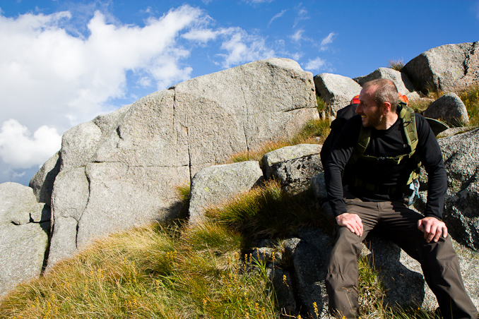
Craignaw is a fine hill. It is mostly a rocky plateau, with some short strenuous ascents to reach the summit. Like pretty much all of the summits in Galloway, the views are amazing (see the panorama at the top of this post). We could now clearly see Loch Dee, which was in the area where we would finish this long walk and get our heads down for the night.
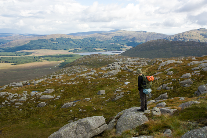
The descent from Craignaw, north to south, is a long, gradual one, most of the way. The rocky landscape is very distinct and interesting: long straight lines that look like they’ve been carved out by boulders carried by a gargantuan glacier.
We descended into the pass between Craignaw and Craiglee, spooking a buck who bounded down the hill with much more grace than we could manage. It was the first deer we had spotted on this trip.
When we reached the valley, it was time to start looking for a suitable pitch. It was wet. Very wet. We were back in the familiar tussocky, overgrown, wet, boggy terrain we had grown to hate. We descended further and started to skirt around the edge of Craiglee, towards Loch Dee, looking out for a good pitch all the way. This was taking us a lot longer than we’d hoped, and by now our legs were getting very tired. We fell over a few times. I was getting frustrated and cranky. We caught back up to the deer we had disturbed earlier and he ran off again. We had got much closer this time and could now see just how big he was.
Eventually, we found a mound on the shores of Loch Dee that was dry enough to pitch the tent. The ground was quite uneven, but we figured it was the best we were going to do, as the sun was going down.
The midges were out again. They hassled us until we retreated to the tent, exhausted. They were spoiling what should have been some of the best parts of the trip: sitting down and relaxing at camp whilst having some dinner. It was then that we decided that the next day, we would not return to Fore Starr, but head all the way back to Loch Doon, where we had left the car.
It had been an epic and exhausting day. I really enjoyed the hills, and ending the day on a a downer only damped the spirits a little. Day 2 route.
Day Three — Loch Dee and the Hike back to Doon
Again, we awoke early, with what seemed like an epic 24km hike ahead of us. Our feet were heavily blistered from all the climbing the day before. We picked a location on the map where we would stop for breakfast (near a decent water source), packed-up early, and headed off. Loch Dee was a picturesque location. The beaches were very pretty, and had we had more time to explore the night before, would have been a perfect place to camp. Although I suspect the midges would still have been an issue.
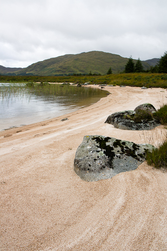
After rounding Loch Dee, we crossed a little footbridge to pick up a trail that was marked on the map that should have taken us a short distance to the Southern Upland way. There was no trail. The terrain was some of the worst and wettest we had encountered yet! After the great start at Loch Dee, this was unwelcome. It took us a lot longer to pass than we’d hoped. However, we reached our breakfast point and enjoyed a brew an some hot food whilst watching the RAF Rescue helicopter head over the Dungeon Hills, possibly towards Merrick.
Just after breakfast, as we set off, it had started to rain, so I put the camera away. With the changeable weather, and the epic hike, I wouldn’t get it out again until we reached Loch Doon that evening. The walk was enjoyable, but very painful. Every step brought that the stinging pain only a big nasty blister brings. Some cars carrying teenagers passed us as we continued north. We stopped off at the Backhill O’the Bush Bothy en route and had a brief chat to two Scottish fellas that had been there overnight. Judging by the empty whisky bottles they’d had a jolly night. I suspect the teenagers had shared the bothy with them. Later on, we were passed by some ATV riders who were out having fun in the forest, and then a couple of hikers who had come from Loch Doon.
Eventually, the track ran out, and we had a few kilometres of forest to cover. Again, the terrain was horrendous and slow and we were very relieved to pick up the path again on the other side, knowing that it would take us all the way back to the car. We reached Loch Doon, and the car by about 17:30. It had been a long day and we were very very exhausted. The views of the loch were fantastic, the evening was nice, and crucially, we were not bothered by midges at all!
And Back Home
We were able to rise at our leisure on the final day, only to take an easy drive around the west of the park, for lunch at the pub we had found on our previous visit: House o’ the Hill Hotel. This place is a highly recommended finishing post for a walk or a cycle in Galloway Forest Park.
All in all, the trip had highs and lows. I’ve grown to loathe the boggy terrain. I love the views. I loved the challenge, the hills, and the epic last-day hike. Regardless of the pain. And when I look back on the photographs, the memories feel a lot more positive. I think this will probably conclude our trips to Galloway for the near future. Certainly to the more remote parts, at least. I may personally return to take advantage of the dark skies in the future, however. But, for now, I’m excitedly looking forward to our next trip: to the Isle of Arran, in Easter.

